| Explanation
|
Term
|
Abbreviation
|
Icon (hot
key)
|
| To set panel
illumination
|
Panel
illumination
|
PANEL
|
 footnote footnote
|
| To set
display brilliance
|
Display
brilliance
|
BRILL
|
 footnote footnote
|
| To select
ECDIS mode (for multifunction displays)
|
ECDIS
|
ECDIS
|
|
| To select
radar mode (for multifunction displays)
|
Radar
|
RADAR
|

|
| To select
Conning display or to select "navigation control data" task of
the INS (for multifunction displays)
|
Conning
|
CONN
|

|
| To select
CAM-HMI as defined in Bridge Alert Management (BAM) (for example
as required by INS)
|
CAM-HMI
|
CAM
|

|
| To select
North Up display
|
North
Up
|
N UP
|

|
| To select
Head Up display
|
Head
Up
|
H UP
|

|
| To select
Course Up display
|
Course
Up
|
C UP
|

|
| To select
True Motion mode
|
True
Motion
|
TM
|

|
| To select
Relative Motion mode
|
Relative
Motion
|
RM
|

|
| To select
ship centred Mode
|
Centred
|
CENT
|

|
| To select
ship off centred Mode
|
Off
centred
|
OFF
CENT
|

|
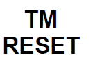
| To perform
True Motion reset
|
TM
reset
|
TM
RESET
|
|
| To select
range
|
Range
|
RANGE
|
|
| To perform
range up (Radar) or to zoom in (ECDIS)
|
Up/In
|
+
|

|
| To perform
range down (Radar) or to zoom out (ECDIS)
|
Down/Out
|
-
|

|
| To identify
the "heading line" off position
|
Heading Line
Off
|
HL
OFF
|

|
| To toggle
Range Rings on and off
|
Range
Rings
|
RR
|

|
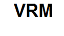
| To set
Variable Range Marker
|
Variable
Range Marker
|
VRM
|
|
| To set
Electronic Bearing Line
|
Electronic
Bearing Line
|
ERBL
|

|
| To perform
Target Acquire
|
Acquire
|
ACQ
|

|
| To perform
selection (for example, target or chart object)
|
Select
|
SEL
|

|
| To call up
the information associated with an object by cursor selection on
its symbol
|
Info
report
|
INFO
REPORT
|

|
| To perform
target cancellation
|
Cancel
|
CNCL
|

|
| To perform
cancellation of all targets
|
Cancel
all
|
CNCL
ALL
|
|
| To
acknowledge an alert
|
Acknowledge
|
ACK
|

|
| To
temporarily silence alerts
|
Silence
|
SLNC
|

|
| To record or
log an event or occurrence
|
Record
Event
|
REC
EVENT
|

|
| Select
default settings
|
Default
settings
|
DFLT
SET
|

|
| Select user
settings
|
Select user
settings
|
USR
SET
|

|
| Save user
settings
|
Save user
settings
|
SAVE
USR
|

|
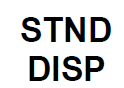
| To select
standard display for chart symbol
|
Standard
Display
|
STND
DISP
|
|
| To execute
Trial Manoeuvre
|
Trial
manoeuvre
|
TRIAL
|

|
| To toggle
Day/Night/Dusk mode
|
Day /
Night
|
DAY /
NT
|

|
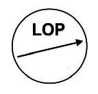
| To plot own
ship position manually
|
Line of
Position
|
LOP
|
|
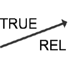
| To toggle
True/Relative Vector mode
|
True/Relative
Vector
|
T/R
VECT
|
|
| Toggle On/Off
AIS
|
Automatic
Identification System contacts on/off
|
AIS
|

|
| To "status
and data display" tasks of the INS
|
Status and
Data
|
STAT
DISP
|
|